Exporting data from Geospatial
This article is for Citizen Space Geospatial. Please speak to your customer success manager if you are interested in learning more about it.
Geospatial data can be exported in the Shapefile format which can then be imported by GIS software for further analysis or manipulation. This allows you to use data collected via Geospatial in a way that suits your existing GIS workflow without modifying the information submitted by a respondent.
There are 3 main ways to export geospatial data from an activity:
- Exporting a single geospatial response
- Exporting all geospatial responses to a question
- Exporting all geospatial responses for an entire activity
Exporting a single geospatial response
To download the Shapefile for a single response:
- Navigate to the dashboard of your activity.
-
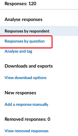
Select the View all responses link under the number of responses box. Select Responses by question in the sidebar menu.
- Select the title of the relevant Geo Draw question.
-
In the list of individual responses, choose the Download option which corresponds to the response you want to export.

You can also download a Shapefile for an individual response via 'Responses organised by Respondent'. Select a response ID and choose the 'Export Shapefile' link below the question response you're interested in.
Exporting all geospatial responses to a question
To download a Shapefile containing all the responses for a particular Geo Draw question:
- Navigate to the dashboard of your activity.
-
Select the View all responses link under the number of responses box. Select Responses by question in the sidebar menu
- Select the title of the relevant Geo Draw question.
-
Above the responses map, choose the Export Shapefile link.

Exporting all geospatial responses for an entire activity
To download a combined Shapefile for all Geo Draw questions, with a separate layer for each question:
- Navigate to the dashboard of your activity.
- Select the View all responses link under the number of responses from your activity dashboard.
-
Select View download options from the sidebar menu.

-
Select Download all geospatial responses (Shapefile) link and select.

